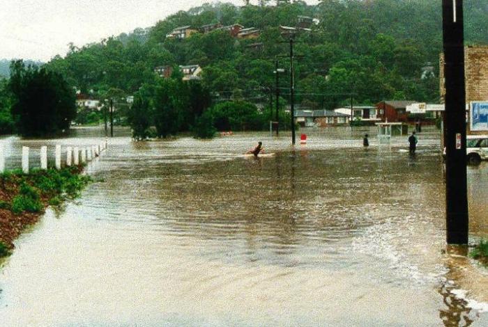
Central Coast Council, as part of its long-term strategy to update flood mapping, is undertaking a flood study for a number of catchments adjacent to the Brisbane Water Estuary. These suburbs include:
- Saratoga
- West Gosford
- Koolewong
- Green Point
- Point Clare
- Woy Woy Bay
- Yattalunga
- Tascott
The aim of this flood study is to better define the nature and extent of flooding within the study area. Additionally, it will allow Council to manage flood risk and minimise the impact of flooding and flood liability to residents living within the catchment area.
The study is being prepared by the consultant Cardno Pty Ltd and is funded by Council.
Community consultation
In 2018, Council engaged with the community – through the form of a questionnaire – to identify flooding “trouble spots” and allow for a targeted assessment of where flood risk reduction measures would be best implemented.
The questionnaire was distributed to all residents and business owners potentially affected by flooding within the study area catchment – a total of 2223 properties. A total of 369 community members responded, 315 responses from physical questionnaires and 54 responded online.
The answers from the questionnaires will be used to inform the flood study.
About Brisbane Water Catchment
Council recently completed an investigation of Brisbane Water Estuary relating primarily to floodwaters that rise up from the ocean (and into the estuary) and overtop seawalls and the foreshore. This type of flooding is referred to as coastal flooding and is often the result of severe coastal events such as storm surge.
This flood study considers the impacts of floodwaters that originate from heavy or prolonged rain causing stormwater to travel down-slope towards the estuary. This type of flooding is referred to as catchment flooding which is associated with increased creek flows.
The suburbs within the catchment are densely populated and the catchment is drained by a network of channels and stormwater drains. During periods of heavy rainfall, stormwater infrastructure can be overwhelmed, exceeding capacity and there is potential for overland or 'flash' flooding across homes and streets which flows into the Brisbane Water Estuary.
For residents within the catchment who have experienced severe flood events in the past, this causes significant disruption and inconvenience. There is also potential for property damage as well as a risk to life.
Got a question?
View the frequently asked questions below - or for more general flood related questions and answers, check out the FAQs on our flood page.
Doc View
Timeline View
What did the results of the community questionnaire achieve
Community Consultation
Community involvement is essential to the success of the overall floodplain risk management process. It enables the community to contribute local knowledge of flood behaviour, along with their concerns and ideas for flood management and allows information to be effectively conveyed back to the community.
For this study, community consultation was undertaken through various approaches. A letter and questionnaire were created for the community to inform the community about the project and to gain an understanding of their experience with historical flooding in the catchment.
The letter invited residents to participate in the study via the questionnaire by providing information on past floods in the catchment, flooding issues of concern, and ideas on reducing existing flood problems.
The survey was distributed to all residents and business owners potentially affected by flooding within the study area catchment, a total of 2223 properties. From the distribution a total of 369 community members responded, 315 responses from physical questionnaires and 54 responded through the online SurveyMonkey questionnaire.
Residences who Experienced Flooding
Residents were asked to provide information about their current address and the time of residence. From the responses, 96% were defined as residential, 2% as commercial, 1% Farming/Rural and 1% defined as other.
Of the total 369 respondents, 39% had been within their property longer than 20 years, 22% between 10 to 20 years, 21% 5 to 10 years and 16% less than 5 years.
Information and depths provided from the community have been used to assist with the calibration of the Hydraulic Model with the final results expeted early 2020
