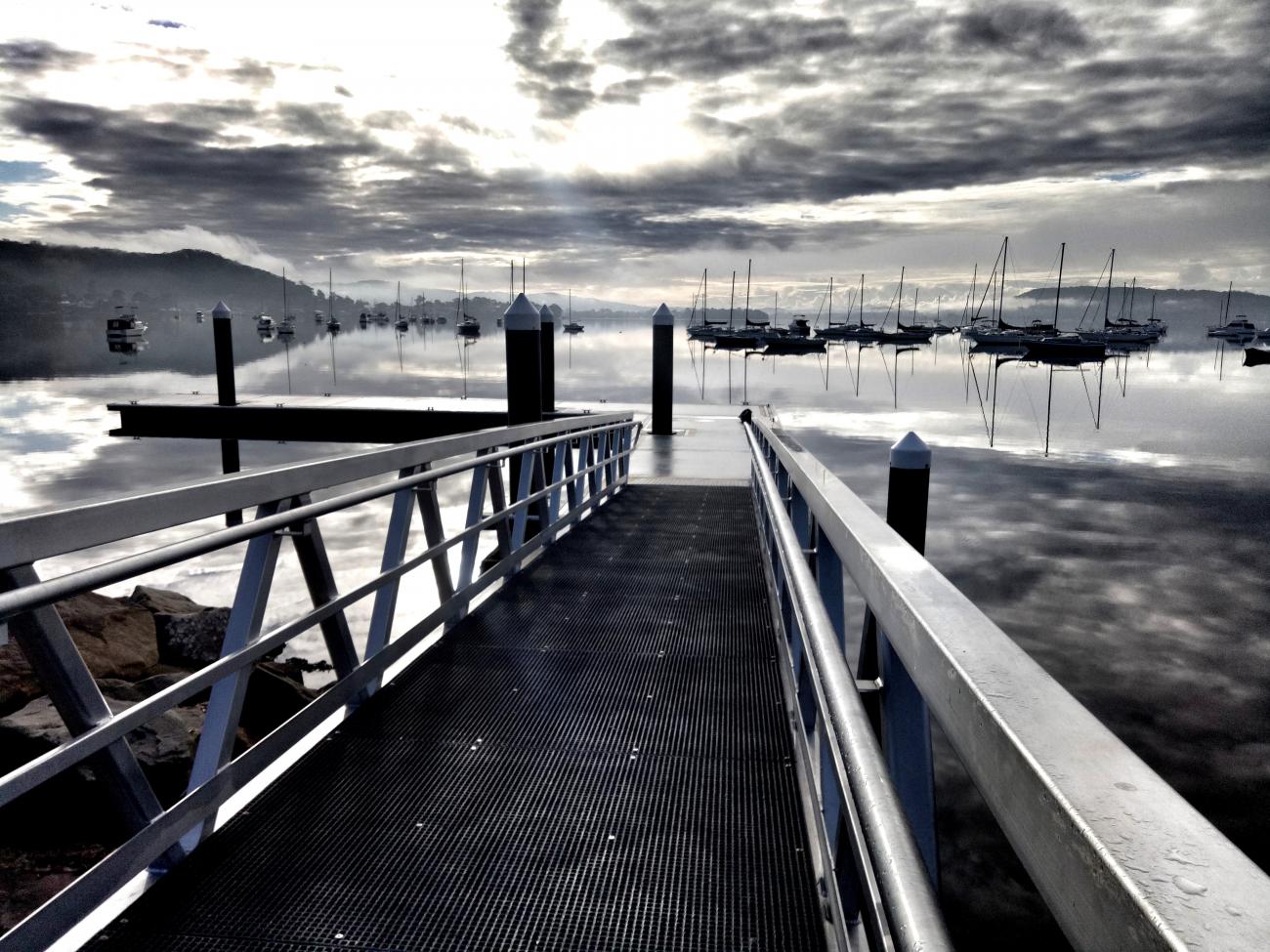
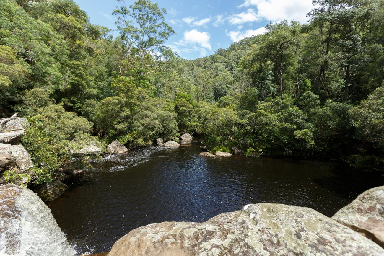
The Hawkesbury-Nepean River system which includes our beloved Brisbane Water is a massive body of water, so much so that it requires management by five other Councils (six, if you include Central Coast Council) and the catchment area extends into 18 wider Local Government Areas.
It’s massive and requires a huge amount of collaboration between the six Councils and more than 20 different state government departments. Luckily, we’re all great collaborators and equally love our waterways.
Over the years, each of the Councils have heard from our various communities through:
- the development of the Brisbane Water Coastal Zone Management Plan and Pearl Beach Lagoon Coastal Zone Management and Lower Hawkesbury Estuary Management Plan
- the feedback you submit on a weekly basis via our Customer Service Centres, emails etc.
- feedback you have provided during consultation opportunities across Council.
We recently conducted a waterways survey which will assist us in plugging the gaps identified and to more broadly understand how you are using our waterways and why - you can view the Our Coast, Our Waterways survey results here!
Stage One Scoping Study
Stage 1 of the HNRS CMP got finalised in April 2020 and resulted in the development of a Scoping Study that has reviewed past management of the river system, developed a shared understanding of the current situation and identified the strategic path for the remaining CMP stages. This study involved collation of existing information, preliminary risk assessment, community consultation strategy, and scoping of technical studies to fill key information gaps.
Stage Two Technical Studies
We developed a range of studies designed to assess key risks, vulnerabilities and identify opportunities to inform future management. These studies were selected for completion by the CMP project team because they addressed the most pressing knowledge gaps as identified in the Scoping Study and were essential for the successful progression of the CMP. This phase involved community engagement, confirmation of key issues and concerns, fieldwork to confirm current knowledge, and completion of identified technical studies to fill key information gaps. Stage 2 got finalised in March 2023 with the completion of five technical studies.
Stage 3 Options Assessment
The project is now transitioning into Stage 3 that will collate the information produced as part of Stages 1 and 2 and use a more complete picture of estuarine processes and relevant management issues to guide the identification, evaluation and selection of appropriate management actions to guide the management of the River system over the next 10 years.
What we have achieved
Up until now, each of the Councils had their own plans and were responsible for delivering the actions in these plans. 88% of the adopted actions have been completed (or are ongoing actions) in the Brisbane Water CZMP, Pearl Beach Lagoon CMP and Lower Hawkesbury EMP. Further information on these actions and Councils work to date can be found at:
- at the Love Our Waterways education website
- on the Davistown Wetland Restoration Works page
- on the Saratoga Wetland Restoration Works page
- on the Bensville Wetland Restoration Works page
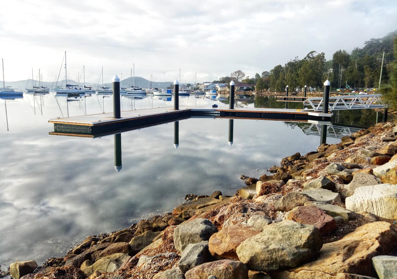
- on the boating page on Councils website
For the other 12%, it is anticipated that, were appropriate, these actions will be carried over into the new Coastal Management Program.


Links
Segmented Documents
Fact Sheets
Community Engagement
Stage One Scoping Study
Stage Two Technical Studies
Timeline
Who's listening
The Hawkesbury-Nepean CMP covers the entire tidal and estuarine reach of the Hawkesbury-Nepean River and associated estuaries including Brisbane Water, Broken Bay and Pittwater. This covers the Local Government Areas of the Central Coast, Northern Beaches, Ku-ring-gai, Hornsby, The Hills and Hawkesbury.
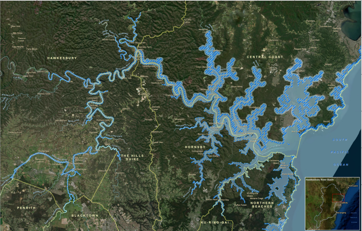
Under the CM Act, councils are required to take a systems approach to coastal management looking at coastal zone management issues in the broader, catchment scale context. The tidal and estuarine reaches of the Hawkesbury-Nepean River system extend from the confluence of the Grose River at Yarramundi 145km downstream to Broken Bay intersecting 6 Local Government Areas. In order to consistently and effectively address catchment-scale issues, it is important that the 6 local councils with management jurisdiction of the river system work together and that one program is prepared to guide this process.
Central Coast is partnering with Northern Beaches, Ku-ring-gai, Hornsby, The Hills and Hawkesbury Councils to develop a whole-of-system CMP for the tidal reaches of the Hawkesbury-Nepean River System. It is envisaged that this CMP will contain actions that address both catchment wide processes as well as LGA specific actions that address local scale issues which will need to be dealt with by the individual council for example Brisbane Water specific actions would need to be addressed by Central Coast Council.
A website which collates the information from all six partnering councils has been developed and is available here.
The broad objectives of the HNR CMP are stated below however it is anticipated that they may be refined during the development of the CMP to reflect stakeholder and community feedback.
- to protect and enhance the integrity and resilience of the environmental values of the Hawkesbury River, Brisbane Water and Pittwater estuaries, including healthy, diverse aquatic ecosystems.
- to maintain and protect water quality across the system and its impacts on environmental, social and economic values - including ecological condition, recreational amenity and agricultural uses;
- to maintain and preserve the unique scenic amenity and natural character of the Hawkesbury River, Brisbane Water and Pittwater estuaries;
- to support the social and cultural values of the system and maintain public access and recreational amenity;
- to maintain the health, safety and wellbeing of those using the coastal zone (both directly and indirectly) - and to protect the health of human consumers of aquatic foods;
- to acknowledge Aboriginal peoples’ spiritual, social, customary and economic use of the Hawkesbury and to protect local indigenous cultural heritage;
- to recognise the coastal zone as a vital economic zone and to support sustainable coastal economies such as recreational fishing, aquaculture and tourism;
- to facilitate appropriate management of the coastal zone through ecologically sustainable development, and the promotion of sustainable land use planning and decision-making that is consistent with regional and local strategic plans;
- to mitigate current and future risks from population growth, urbanisation and coastal hazards (erosion and inundation of foreshores caused by tidal waters and the action of waves, including the interaction of those waters with catchment flooding);
- to ensure co-ordination between relevant government and public authorities relating to the river system - and to facilitate the proper integration of management activities across all levels of government;
- to maintain meaningful engagement with the community, and to support public participation in coastal management and planning, and to create greater public awareness, education and understanding of coastal processes and management actions;
- to encourage and facilitate research and monitoring – and to maintain the scientific and educational values of the river system;
- to support the objects of the Marine Estate Management Act 2014; and
- to align with the NSW Risk-based Framework for Considering Waterway Health Outcomes in Strategic Land-use Planning Decisions.
Yes. The Lower Hawkesbury River Estuary Management Plan was developed in 2008 by Hornsby Council in collaboration with Gosford Council. In addition to this there are 3 existing Coastal Zone Management Plans relevant to the study area including:
The Coastal Zone Management Plan for Brisbane Water (adopted by Gosford City Council in 2012);
The Coastal Zone Management Plan for Gosford’s Beaches (certified by the Minister for the Environment in 2017); and,
The Coastal Zone Management Plan for Pearl Beach Lagoon (certified by the Minister for the Environment in 2017).
There are 6 councils with management jurisdiction over the tidal reaches of the Hawkesbury-Nepean River System:
- Central Coast Council
- Northern Beaches Council
- Ku-ring-gai Council
- Hornsby Shire Council
- The Hills Shire Council
- Hawkesbury City Council.
There are 6 councils with management jurisdiction over the tidal reaches of the Hawkesbury-Nepean River System:
- Central Coast Council
- Northern Beaches Council
- Ku-ring-gai Council
- Hornsby Shire Council
- The Hills Shire Council
- Hawkesbury City Council.
The HNR CMP will be delivered by the project steering committee which consists of representatives from the NSW Department of Planning, Industry and the Environment and from each of the 6 partner councils.
A website which collates the information from all 6 partnering councils has been developed and is available here.
Council has a water quality monitoring program in place for all its waterways, including Brisbane Water and the Lower Hawkesbury River. Sampling of these areas began in 2017-18 (Brisbane Water) and 2018-19 (Hawkesbury River). These programs help to understand past and current condition, identify where we need to focus our management actions and determine long-term trends in water quality and ecological health.
Sampling is undertaken by scientists throughout the year at a number of representative sites. Data is collected on site condition, water chemistry, nutrient concentrations and a range of biological indicators which tell us about the health and resilience of each area. The program aligns with the NSW Estuary Monitoring, Evaluation and Reporting Protocols and allows us to compare our results to other estuaries in NSW.
The 2019-20 Waterways Report Card for the Central Coast Local Government Area has been released and includes Southern Lake Macquarie, Tuggerah Lakes, Brisbane Water, the Lower Hawkesbury River and the coastal lagoons – providing a clear picture of our entire waterways network. The 2019-20 report tells us:
- Of the 36 sites sampled, 25% are excellent, 39% are good, 33% are fair and 3% are very poor
- Brisbane Water estuary is generally considered good or excellent, with fair ratings at Narara Creek, Erina Creek and Kincumber Broadwater
- Water quality throughout the Tuggerah Lakes estuary was generally good, with fair results for Budgewoi Lake, Wallarah Creek, Canton Beach, Ourimbah Creek and Killarney Vale and an excellent rating for Chittaway Bay
- The water quality at our southern Lake Macquarie sites is excellent
- Our coastal lagoons vary from excellent at Cockrone Lagoon to very poor at Avoca Lagoon.
Council uses this information to track change, help guide our management decisions and identify areas where more detailed catchment audits are required.