Initial consultation period has now closed
Thank you to everyone who completed the questionnaire as part of our initial consultation. Your input greatly appreciated and will be used to help inform the study.
Central Coast Council is committed to keeping our community safe and well-informed about flooding. To achieve this, Council regularly updates Flood Studies and Floodplain Risk Management Plans for all catchments across the Central Coast.
The original flood study for Gosford was completed in 2013. Since this time, Gosford and its surrounding suburbs have experienced a significant uptick in development and population growth. An updated flood model will reflect these present-day conditions using advanced flood modelling techniques.
This Flood Study is a key step in the Flood Risk Management Process and will help Council make more informed decisions in relation to land use planning, which supports a safer and more resilient community.
This project is supported by funding from the NSW Government’s Department of Climate Change, Energy, the Environment, and Water and is managed in line with the NSW Government’s Flood Prone Land Policy.
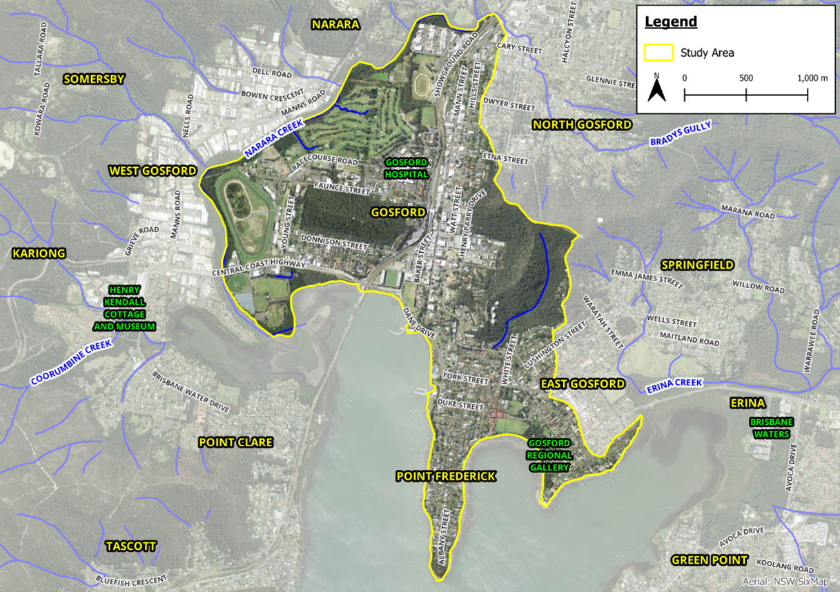
Gosford Overland Flood Study area
How we heard from you
We valued local knowledge and personal community experiences, as it provides useful insight into past floods in the Gosford, West Gosford, Point Frederick and East Gosford areas.
By completing a short questionnaire, you helped Council to develop robust flood model that reflects real life flood behaviour. The more information we collect, the more reliable our flood model can be.
The questionnaire was open from Monday 10 November to Monday 8 December 2025.
Hard copies of the questionnaire were also available at Gosford Regional Library to complete and submit if you preferred pen and paper!’
Your attention was drawn to the provisions of the Government Information (Public Access) Act 2009 which allows for possible access to certain public and personal documentation. View our privacy statement.
Why your voice matters
Your involvement is essential to the success of the floodplain risk management process as it enables Council to:
- Identify local concerns and values
- Improve the accuracy of flood modelling
- Shape decisions that reflect community needs
- Improve community safety and preparedness
- Inform land use planning and development decisions
- Support emergency response planning
- Build community resilience to future flood events.
More information
Check out the FAQs to learn more about what a flood study is, why an update is needed, the flood risk management process we follow, the different types of flooding and more.


