
Council has a duty of care to manage lands subject to flooding within its Local Government Area. Under the NSW Government’s Flood Prone Land Policy the local government has a responsibility for managing flood liable land.
Council is responsible for formulating and implementing Floodplain Risk Management Plans in accordance with the policy.
| Catchment area | Type | Suburbs | Status |
|---|---|---|---|
| Davistown and Empire Bay |
Floodplain risk management study and plan |
Davistown, Empire Bay and portions of Bensville |
|
| Lake Macquarie Catchments |
Overland flood study |
Mannering Park, Summerland Point, Gwandalan, Kingfisher Shores, Chain Valley Bay and parts of Doyalson, Doyalson North, Lake Munmorah and Crangan Bay |
|
| Northern Lakes |
Floodplain risk management study and plan |
Wyongah, Gorokan, Lake Haven, Charmhaven, San Remo, Buff Point, Budgewoi, Halekulani, Lake Munmorah, Noraville, Toukley and Norah Head |
|
| Ourimbah Creek |
Floodplain risk management study and plan |
Ourimbah and parts of Chittaway Bay, Chittaway Point, Kangy Angy, Tuggerah, Palm Grove, Palmdale, Fountaindale, Lisarow, Central Mangrove, Kulnura and Mount Elliot |
|
| Wyong River |
Floodplain risk management study and plan |
Wyong, Wyong Creek, Hamlyn Terrace, Halloran, Durren Durren, Yarramalong, Dooralong, Lemon Tree, Jillby, Little Jilliby, Alison, Mardi, Ravensdale, Cedar Brush Breek |
|
| Killarney Vale and Long Jetty |
Floodplain risk management study and plan |
Bateau Bay, Shelley Beach, Long Jetty, Killarney Vale and sections of The Entrance |
|
| Wallarah Creek |
Floodplain risk management study and plan |
Blue Haven, Wallarah and Bushells Ridge, and parts of Doyalson, San Remo, Charmhaven and Woongarrah |
|
| Woy Woy |
Floodplain risk management study and plan |
Woy Woy, Blackwall, Ettalong and Umina |
|
Links
Segmented Documents
Timeline
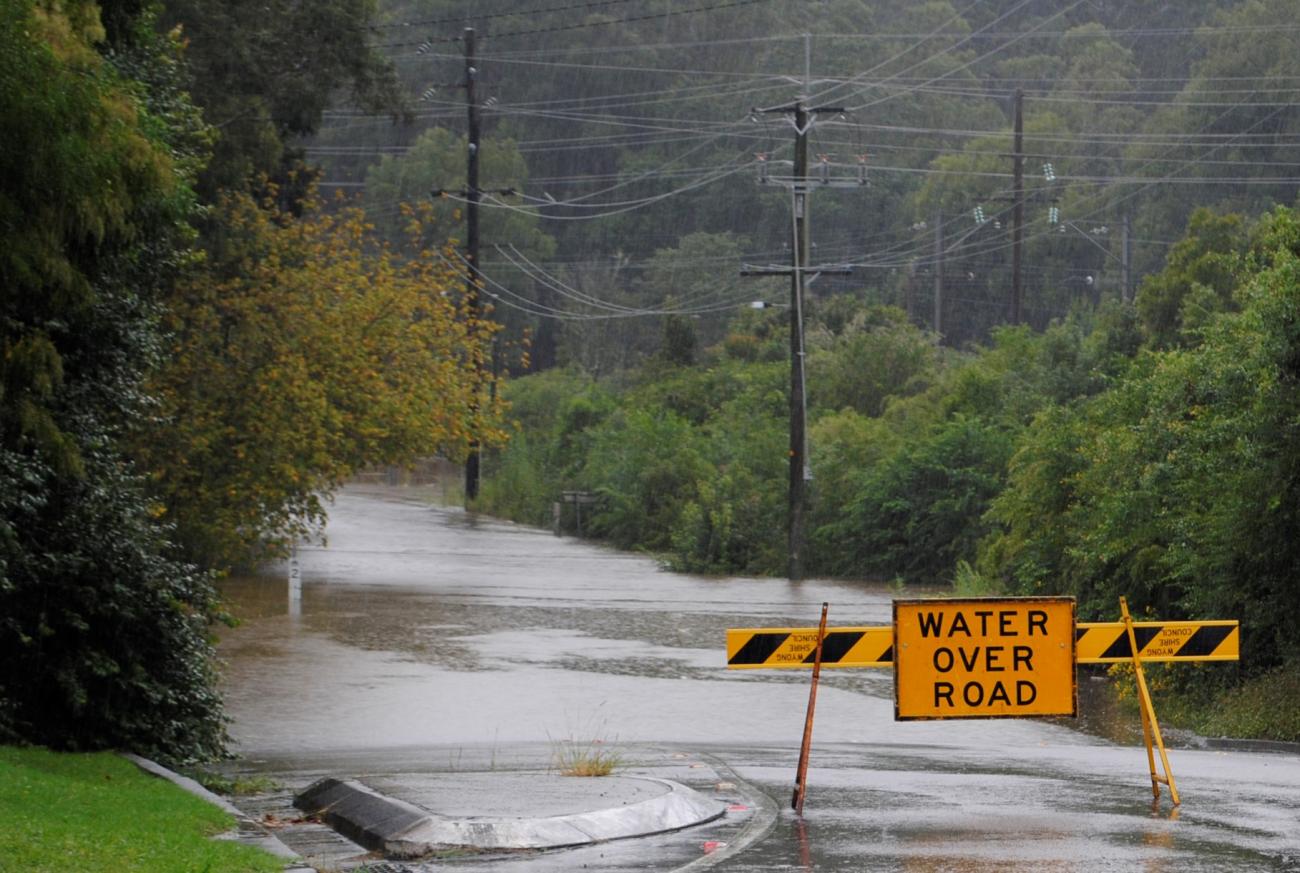
Can flooding be prevented?
Flooding is a natural part of how waterways work. There will always be a possibility of flooding for various reasons and when large amounts of rain falls. However, infrastructure can be designed to reduce the impacts and risks of flooding by slowing the water down, stopping it reaching certain areas, or by having appropriate planning instruments in place to prevent building in flood prone areas.
What is a floodplain risk management study?
A floodplain risk management study utilises the information from the preceding flood study to identify, assess and compare various flood risk management options and consider opportunities for environmental enhancements as part of flood mitigation works.
The management study provides information and tools to allow strategic assessment of the impacts of management options for existing, future and continuing flood risk on flood behaviour and hazard. It also allows for a robust assessment of the social, economic, environmental and cultural issues and costs and benefits of all options.
What is overland flooding?
Overland flooding is caused by excess rainfall runoff which flows across the land before it enters a creek or stream. A combination of factors lead to excess rainfall runoff including:
- inadequate drainage
- a build-up of impervious surfaces overtime (such as concrete surfaces)
- the ability of the ground to absorb water.
Overland flooding tends to affect localised areas rather than the whole suburb at once
What is flash flooding?
Flooding that is sudden and unexpected is referred to as flash flooding. It is usually caused by intense thunderstorms which deposit a large amount of rainfall in a short period of time.
What causes flooding?
What is overland flooding?
Overland flooding is caused by excess rainfall runoff which flows across the land before it enters a creek or stream. A combination of factors lead to excess rainfall runoff including:
- inadequate drainage
- a build-up of impervious surfaces overtime (such as concrete surfaces)
- the ability of the ground to absorb water.
Overland flow flooding tends to affect localised areas rather than the whole city at once.
Why does Council conduct studies and plans?
Flooding has the potential to cause considerable damage and disruption to a community. In addition to tangible damage, floods also impose high levels of intangible damage such as increased levels of stress on affected communities. Council undertakes studies so there is a better understanding of the flood hazard in the study area, and the information from the flood study will be used as the basis of a future floodplain risk management study for the area.
The main objectives of the floodplain risk management process are to:
· minimise risk to life, health and safety
· reduce flood damage to property and infrastructure in the existing community
· ensure future development is controlled in a manner which is compatible with a catchments flood risk
· protect and enhance the floodplain environment and be consistent with relevant state government policies
· ensure that the flood study and/or floodplain risk management study and plan has the support of the local community.
Can flooding be prevented?
Flooding is a natural part of how waterways work. There will always be a possibility of flooding for various reasons and when large amounts of rain falls. However, infrastructure can be designed to reduce the impacts and risks of flooding by slowing the water down, stopping it reaching certain areas, or by having appropriate planning instruments in place to prevent building in flood prone areas.
What causes flooding?
Flooding occurs when water covers land that is normally dry. Flooding may be due to heavy rains, overflowing of the rivers, creeks and waterways, broken dams, storm surges and tsunamis, lack of capacity in the drainage system, broken pipes and many other reasons.
What is the probable maximum flood (PMF)?
The probable maximum flood (PMF) is the largest flood
that could possibly occur. It is a very
rare flood (much rarer than the 1% AEP flood). Despite this, a number of
historical floods in Australia have approached the magnitude of a PMF. Every
property potentially inundated by a PMF will have some flood risk, even if it
is very small. Councils are required to
consider all flood risks, even these potentially small ones, when managing
floodplains.
Why do flood levels change over time?
Flood levels are typically estimated using computer models. Computer models are the preferred method for establishing flood levels as they can be used simulate a range of floods including floods well in excess of those that have been experienced since settlement of the area. Given the importance of estimating flood levels accurately, Councils engage experts to establish and operate the computer models.
From time to time the computer models are revised and predicted flood levels can change. The resultant change in flood levels however is normally very small. The reasons why the computer models are revised can include:
- New rainfall or ground topography information becomes available;
- New floods occur which provide additional data from which to fine-tune the models;
- Better computer models become available as the science of flood modelling improves and computer capabilities increase; or
- Flood mitigation works may have been carried out, or development within the catchment may have occurred, that was not previously represented in the models.
How do I obtain flood information for my property?
Council has flood maps available for its main waterways which give an indication of areas that will most likely be affected by various flood events. However, these maps are not detailed enough to provide flood levels for individual properties.
If you require more detailed information from that supplied on the maps and in relation to a Development Application, you can complete a Flood information application.
Note: It is not Council's general practice to provide flood information about a property over the phone.
Is my house protected by flood mitigation measures?
Many areas on the Central Coast have flood mitigation measures in place. These measures may include a levee bank, a channel that has been widened, a floodgate, a detention basin or larger drains which aim to reduce the frequency of flooding and the length of time the stormwater remains on flood liable properties.
However, these measures can fail in severe and prolonged storm events, therefore it is important to be prepared for a major flood if your house is located on identified flood liable land or within close proximity to a creek, water course, water body, depression, etc.
To find out whether your property is within an area identified as being affected by flooding up to a 1% AEP flood event, please refer to the flood mapping section.
Am I liable for any work I do in a drainage easement, flood area or watercourse?
Will identifying my lot by Council as being subject to flood related development controls affect my insurance premiums?
Yes, it may.
Insurers use data from a variety of sources, including the flood information generated as part of a floodplain risk management study and plan. They can use this data to define the potential risk of flooding and to cost insurance premiums accordingly (i.e. high-risk properties will have higher premiums relative to low-risk properties). As updated flood information is made available to insurers, they will be able to re-evaluate the flood risk for individual properties and adjust insurance premiums. In some instances, premiums may go up and in other instances premiums may go down.
If you are not satisfied with the cost or coverage of your insurance, you can shop around to find another product suitable for your needs. The Insurance Council Australia has setup some websites to help people find an insurer and understand insurance.
What is Council doing to help reduce the cost of flood insurance?
Building new developments to a standard that can better respond to current and future flood risk, such as setting appropriate floor heights or using flood-proof building materials, can reduce the impact a flood will have on the property. This will also reduce the chance of having to make a claim on your insurance.
Central Coast Council is
also working to make information about the potential
impact
of floods – including
flood levels and floor levels – more easily available to owners, buyers, lenders and insurers. When insurers are uncertain about flood risk they are likely to charge more for flood cover. If councils are able to provide insurers with clear, up to date
information they can be more accurate in their risk assessment.
This often
means a reduction in premiums.
Why am I charged a premium even though my property is not affected by the 1% AEP flood?
Although your home might be outside the 1% AEP flood zone, its floor height may be above the 1% AEP flood level or protected by a levee, there may still be a chance your home could be flooded. Insurers have to cover even the most rare and extreme floods. There are floods that are bigger than a 1% AEP flood. There are also floods that will overwhelm most flood mitigation structures, including levees and dams.
In most cases, if your property is only at a risk from a very rare and extreme flood, the risk is very small and, as a result, the premium charged should reflect the lower risk.
However,very rare and extreme events can also cause very severe damage. So although the chance of it happening may be small, the potential cost of fixing the damage caused by the flood could be very high.
If there is information that a property is at risk from
a very rare and extreme event some insurers may take that it into account when deciding how much
to charge you.