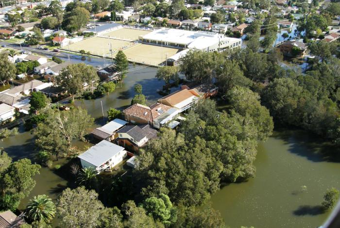
Central Coast Council has prepared a draft Floodplain Risk Management Study and Plan for the Northern Lakes catchment with financial assistance from the NSW Government through their Floodplain Management Program. The draft report was prepared following extensive community consultation throughout the project including public exhibition in February 2021, and detailed assessment of flood risk management measures.
The Northern Lakes Floodplain Risk Management Study and Plan were adopted in the Council meeting on Tuesday 11 October 2022.
You can view the adopted plans on the Strategies and Plans page of the Council website.
About the draft Study and Plan
The Northern Lakes catchment is subject to overland flooding across suburbs immediately surrounding Lake Munmorah, Budgewoi Lake and the northern part of Tuggerah Lake, from Tuggerawong and Norah Head in the south to Lake Munmorah in the north including:
- Wyongah
- Gorokan
- Lake Haven
- Charmhaven
- San Remo
- Buff Point
- Budgewoi
- Halekulani
- Lake Munmorah
- Noraville
- Toukley
- Norah Head
The suburbs within the catchment are densely populated and the catchment is drained by a network of channels and stormwater drains. During periods of heavy rainfall, stormwater infrastructure can be overwhelmed, exceeding capacity and there is potential for overland or 'flash' flooding (overland flooding) across homes and streets which flows into the Northern Lakes.
For residents within the catchment who have experienced severe flood events in the past, this causes significant disruption and inconvenience. There is also potential for property damage as well as risk to life.
The aim of this Study and Plan is to reduce the impact of flooding and flood liability on the residents living within the catchment area. As part of the NSW Government's Flood Prone Land Policy, consideration is given to social, economic, environmental and flood risk parameters to help evaluate a range of flood mitigation measures.
The Study and Plan prepared by the consultant Manly Hydraulics Laboratory for Council and is funded by Council with additional funding from the Department of Planning, Industry and Environment (DPIE).
Engagement Summary
Council invited all residents within the study area to complete a survey prepared by the flood consultant, Manly Hydraulics Laboratory, to help identify flooding “trouble spots” and allowing for a targeted assessment of where flood risk reduction measures would be best implemented. This questionnaire closed on 14 December 2019.
Between 15 February and 15 March 2021 Central Coast Council publicly exhibited the Northern Lakes Floodplain Risk Management Study and Plan.
During the consultation period the community were invited to:
- review the draft Northern Lakes Floodplain Risk Management Study and Plan.
- attend a community drop in session: Tuesday 2 March, 4-7pm, at Blue Haven Community Hall, 1 Apsley Court, Blue Haven, and Wednesday 3 March, 4-7pm, at Halekulani Community Hall, Halekulani Oval, 107 Scenic Drive, Budgewoi.
- register for a one-on-one online session to discuss the draft reports with Council project officers.
- read our frequently asked questions on our main floodplain management page.
Submissions were also accepted via email, mail and online form until 5pm Monday 15 March 2021.
Read more in the Engagement Summary here.
Got a question?
Visit our floodplain management page and check out our FAQs.
*This website does not necessarily represent the opinions of the NSW Government or the Department of Planning, Industry and Environment.
